Internet Accuracy Project

Home
Table of Contents
Place Name Index
Biographical Index
Reference Book Errors
Commonly Confused Words
Automotive Place Names
Valentine's Place Names
Halloween Place Names
Christmas' Place Names
Bethlehem Place Names
California Place Names
Montana Place Names
Oregon Place Names
Place Names in Texas
Unusual Town Names
Washington Place Names
Convict Lake, California
Crapo, Maryland
Crook, Colorado
Devils Den, California
Dickshooter, Idaho
Hell, Michigan
Hopeulikit, Georgia
Horneytown, North Carolina
Jot 'Em Down, Texas
Looneyville, Texas
North Pole, New York
Tincup, Colorado
Truth or Consequences, NM.
Two Egg, Florida
Valentine, Nebraska
Warroad, Minnesota
Record Temps in the U.S.
U.S. Plant Hardiness Zones
U.S. Precipitation/Freeze dates
Weights and Measurements
Artificial Heart Invention
Internet Country Codes
Task Force Acronyms
U.S. Police Acronyms
Wind Chill Charts
Heat Index Charts
Police Acronyms
Witty Acronyms
U.S. Presidents
U.S. Statehood
World Capitals
U.S. Capitals
2012 Calendar
2013 Calendar
U.S. Time Zones
Roman Numerals
Perpetual Calendar
U.S. Postage Rates
U.S. Mail Holidays
Guide to Leap Years
Daylight Saving Time
Free eBooks (A - D)
Free eBooks (E - Hd)
Free eBooks (He - Hz)
Free eBooks (I - L)
Free eBooks (M - P)
Free eBooks (Q - R)
Free eBooks (S - V)
Free eBooks (W - Z)
Frequently Asked Questions
Contribute Used Books
Sources/References
Recent Updates
Link to Us
Blog
Contact Us
Cookietown, Cotton County, OK.

City, town or villageCountyStateCountryElevation
CookietownCotton CountyOklahomaUSA1030 feet (314 meters)

Latitude (DMS format)Longitude (DMS format)Map on which this town can be found
34° 16' 30"N98° 27' 12"WCookietown

Cookietown, Oklahoma is located at the crossroads of U.S. 277/281 and SH-5A, in Cotton County, near the Texas border.

Origin of its unusual name
The tiny southwestern Oklahoma community was named after a local business owned by Marvin Cornelius back in the early twentieth century.

Nearby cities and towns:
Randlett, Oklahoma (to the south)
Devol, Oklahoma (to the southwest)
Loveland, Oklahoma (to the west)
Lawton, Oklahoma (to the north)
Walters, Oklahoma (to the northeast)
Temple, Oklahoma (to the east)
Taylor, Oklahoma (to the southeast)
Burkburnett, Texas (to the southwest)

Time Zone: Cookietown, Oklahoma is in the Central Time Zone.

Over the years, points of interest in the region have included:
* Cameron University, in Lawton, Oklahoma
* Fort Sill Military Reservation and National Historic Landmark, north of Lawton, OK.
* Waurika Lake, near Waurika, Oklahoma
* Wichita Mountains Wildlife Refuge, northwest of Lawton, Oklahoma

Recreational opportunities in the area:
Camping, fishing, hunting, archery, picnicking, hiking, rock climbing, photography, boating and water-skiing.

Wildlife found in southwest Oklahoma:
Bison, elk, deer, wild turkey, coyotes, hawks, quail, dove, ducks, rabbits, prairie dogs, otter, owls, raccoon, and the armadillo.
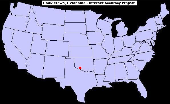

U.S. map showing the location of Cookietown, Oklahoma


For an extensive list of other odd town names in the United States, visit our page of unusual, bizarre or humorous names of towns.

If you find the above data useful, consider recommending Internet Accuracy Project to your friends and colleagues. Thank you in advance!

Copyright © 2005-2012 INTERNET ACCURACY PROJECT. All rights reserved. All content, is the exclusive property of Internet Accuracy Project and may not be reproduced (on the Web, in print, or otherwise) without the express written permission of our organization. BY ACCESSING THIS SITE YOU ARE STATING THAT YOU AGREE TO BE BOUND BY OUR TERMS AND CONDITIONS regardless of whether you reside in the United States of America or not. Our Privacy Policy. This page was last updated January 1, 2012.